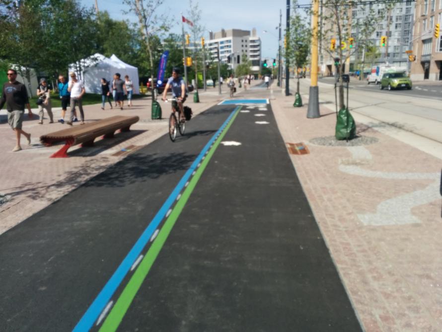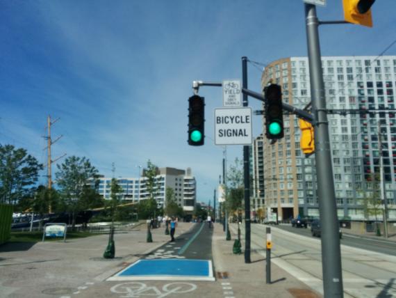
Looks so much better. Works so much better. We now have a true separation from cars from Etobicoke to the Beach! A really useful and comfortable bikeway (sure, it's a multi-use trail but it really looks like a bikeway). Bike-specific lights.

Even so there are some wrinkles. While people cycling now don't have to share with cars, there will be ongoing tension with pedestrians. It was forward thinking to make the multi-use path asphalt to make it look less like a place to walk. However, more can be done to encourage walkers to choose the space exclusive to walking.
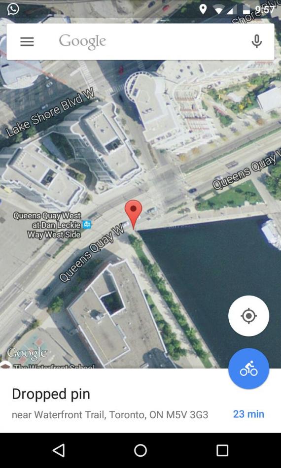
One spot that will become a real pain is on the east end of Harbourfront Centre at the Portland Slip where the bike path disappears and everyone is squeezed into a narrow section.
On Twitter Anton Lodder pointed out the spot:

Waterfront Toronto is collecting feedback on the new Queens Quay. Have your say!
They're already aware of some issues and are planning to make some changes. Those relevant to the cycling infrastructure:
- We’ve heard from many of you that you’re concerned about the gap in the Martin Goodman Trail as you cross the Portland Slip at Queens Quay and Dan Leckie. The ultimate vision for this spot – a WaveDeck – is included in both our Central Waterfront precinct plan and the City of Toronto’s proposed Bathurst Quay Neighbourhood Plan but is currently unfunded. This will create the necessary space for a wide promenade separate from the Martin Goodman Trail. We explored the possibility of creating a temporary deck over the lake in this area, but because building any structure over the lake is complex, this was a prohibitively expensive solution. In the short-term, we’re working with the City of Toronto to determine how best to alert cyclists to the 60-metre gap in the trail (line painting or additional signs). We’re also assessing an interim solution that would create more space at this pinch point. Because this extension of the Martin Goodman Trail was only approved and tendered in January 2015, there was no time to implement any such solution before the Pan Am / Parapan Am Games. We felt it was more important to open the new Martin Goodman Trail from Bathurst to Stadium Road with a less-than-perfect solution in this short area than not to open it at all.
- We’ve recommended that the City approve standard trail signs to mark the Martin Goodman Trail along the south side of Queens Quay
- We’ve heard that people would like stop signs on the south side of Queens Quay for cyclists crossing at Stadium Road and Little Norway Crescent and are prioritizing that request
Waterfront Toronto doesn't provide any guidance on when and how the pinch will get funded. Perfectly understandable that there wasn't enough time to figure that out—the whole section west of Spadina was last minute. A great improvement over the mess that would have been.
Perhaps Councillor Joe Cressy could use a bit of the big pot of Section 37 money to pay for this small bit of infrastructure? Surely, there's money somewhere. Toronto has money to spend a half billion on 3000 drivers so why not a few thousand on this?

Comments
W. K. Lis
Meanwhile, the rest of world
Wed, 07/01/2015 - 15:32Meanwhile, the rest of world uses actual bicycle symbol traffic signals, but not here in Toronto because it would be illegal to do so in Ontario. Hopefully, the study to do the change will let the decades slip by fast.
Clark in Vancouver (not verified)
It looks good for the most
Wed, 07/01/2015 - 18:15It looks good for the most part. I don't like the idea of there being nothing more than a colour difference to show where to bike and where to walk. It might be okay though.
That pinch point is going to be a problem. It's good that they know that. Hope they study it and eventually cough up some money for a good design solution.
Antisthenes (not verified)
Rode through on a working
Thu, 07/09/2015 - 13:40Rode through on a working Monday. Tourons all over it. Cannot imagine a weekend, and am never tempted to go see.
W. K. Lis
Total lack of detour signs on
Sat, 07/11/2015 - 17:54Total lack of detour signs on the Martin Goodman Trail around Ontario and Exhibition Place, at the start of the Pan Am Games. If I didn't know the area, I would have turned back.
There was a sign at Strachan Avenue saying to use British Columbia Avenue. Except that British Columbia Avenue does not even reach or begin at Strachan Avenue. Have to use Manitoba Drive, next to the streetcar tracks.