The Ontario Liberals promised $25 million towards cycling infrastructure this year. While this is certainly better than zero dollars and while cycling organizations such as Share the Road did good to get excited about it, I'm going to look at the gift horse in the mouth. I'm here to provide the horse droppings on the parade (or some such metaphor).

For the 2013-14 fiscal year Ontario dedicated about $6 billion towards transit and highways. The $25 million for cycling infrastructure is over three years and spread out across a population of 13.5 million. That comes out to 60 cents a person per year. Compare that to $450 per person per year for transit and highways!

The Ontario government loves cycling about 0.1% as much as they love big transit and highway projects.

I'm well aware that province-wide that cycling rates are low (though they do increase quite a bit when we include all the recreational cycling), the rate is still an order of magnitude higher than 0.1%. Toronto as a whole is around 2% but there are parts of central Toronto that are almost 20%.

While the announcement is certainly good news, it is just barely so. It will have a minor impact on transportation choices in this province. The best thing the government could do would be to pick just 2-3 big projects in cities where there is a sweet spot of a high impact on bike mode share and a willing city government to quickly implement the change. Otherwise the money might be spread too thinly to even be noticeable.

Perhaps if cyclists across this province went around our neighbourhoods and asked for 60 cents from all our neighbours we could double this tiny fund in no time.

The good news, as cycling advocates have pointed out, is that Ontario will now incorporate cycling infrastructure into all provincial highway and bridge work.

“The experience of jurisdictions where they do that is it actually doesn’t cost you any more because… you basically integrate it. You can see it on Highway 7 in Toronto: You’ll see the Viva (bus) lines, you’ll see a sidewalk and you’ll see a roadway with several lanes on it and you’ll see a cycling trail. From now on, we’ll just simply build it in like we build sidewalks unless there’s a cost reason,” he said.

The exception will be where it doesn’t make sense, such as in Brampton, where there are sidewalks along highways that aren’t being used. Those are being re-purposed as active transportation corridors.

This will have a longer term impact even though the changes will be slow to be seen since it doesn't involve actual retrofitting of highways that don't have other work scheduled. And it doesn't seem to include any policy directive for municipalities to do the same for their own infrastructure projects. Neither has the province promised to make implementing cycling infrastructure easier. Councillor Denzil Minnan-Wong has been frustrated--as have most cyclists--that the implementation of protected bike lanes on Richmond and Adelaide has dragged on for years, partly because of the onerous environmental assessment process:

The public, he said, doesn’t understand the “convoluted” environmental assessment process that means it can take four or five years to realize a project.

Let me pat you on the back Minister Glen Murray, but we've only just started.

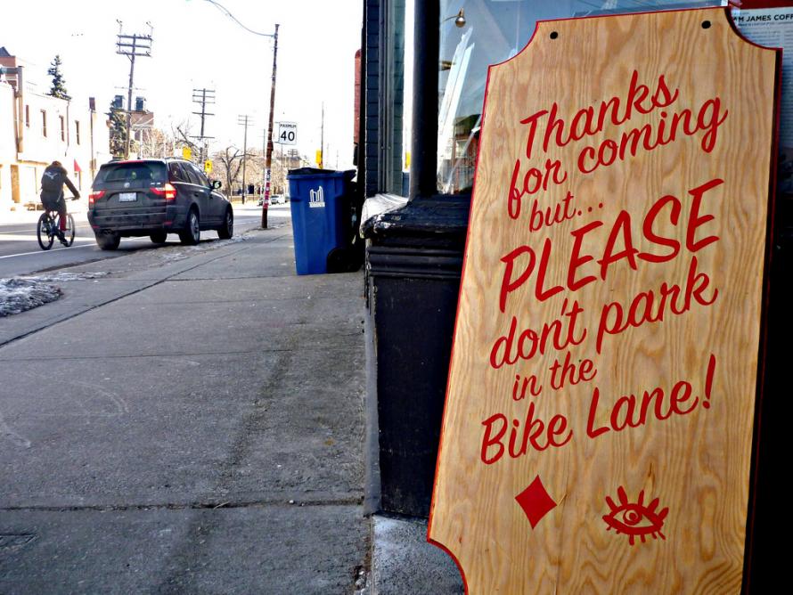
Today is one of your last chances to tell city staff that their revised plan for Harbord and Hoskin falls short of providing good protection for cyclists. (Photo of Sam James coffee shop on Harbord by Tino)

Their latest plan will continue to put cyclists next to the door zone, allow cars to park in bike lanes at their convenience and continue to fall short of what City Council asked of them to build.

Today, Thursday, March 27, 2014 from 4 p.m. to 8 p.m you can drop in at Kensington Gardens, 45 Brunswick Ave. North Building, Multi-Purpose Room, to explain to them you want something better.

City Council asked for protected bike lanes (aka cycle tracks). Staff are now offering something that falls short. While their proposal helps fill in the gap in the Harbord bike lane, their proposal is basically a bike lane with a wider painted strip.

City would be letting down families and students who might only bike if they felt that they had separation from car traffic.

  • Cyclists will still ride right next to car traffic that speeds on a road that is forgiving for high speeds and not for new cyclists.
  • Car drivers will still park in the bike lane whenever they feel like it.
  • The bike lanes will get no special treatment regarding snow clearing, unlike Sherbourne.
  • Cars will park right next to the bike lane continuing to put cyclists in the door zone.

In short, cyclists will continue to be treated like peppercorns in the pepper grinder of car-centric traffic planning. It's like bike planners expect cyclists to act as traffic calming with our own bodies.

City staff were too timid to propose removing all the car parking along Harbord, which is why they had proposed the bidirectional in the first place. But now that they've done a questionable traffic study, they've backed away and can only fit in a unidirectional painted bike lane. Business as usual.

The fact is, staff do not really know if their proposed unidirectional plan is safer than the previous bidirectional plan. They just figured they'd choose the option that meant less traffic delays. They mention turning movement conflicts in the case of bidirectional, which they try to mitigate in the study, but they haven't been able to put it in the context of conflicts of regular bike lanes: dooring, collisions from behind, sideswipes from cars entering/exiting parking. We don't really know which is more dangerous. All we have to go on are the existing scientific studies that have suggested that bidirectional protected bike lanes work and are safe in places such as Montreal.

Staff have been unable to confirm with me that the model they used can accurately reflect reality. Has anyone who has used this model and then built some bike lanes gone back to measure the traffic speed to see if the model made a solid prediction?

And they haven't even been able to confirm if they know what the margin of error is. That is, if the traffic study states that in a scenario traffic will be slowed by 5%, the margin of error could be higher than 5% for all we know. This is something basic that we see in every poll ever done so we have an idea of the significance of the numbers. Meanwhile, with their traffic study, we have no idea of the significance of the numbers, nor do we know if it has a track record of accuracy. So why should we put any faith in at all unless staff can tell us this?

Finally, what's so bad about slowing down traffic? In one of the traffic study's scenarios cyclists got an advanced green to give them a head start over car traffic. That actually sounds really great! Why not implement that for all our key cycling routes?

This traffic study did not study all the options out there for improving the safety of cyclists at intersections. It only looked at the status quo intersections. For instance, it could have looked at protected intersections like they install in the Netherlands.

So this is what we could ask of staff:

  • Go with fully protected bike lanes, either the original bidirectional plan or unidirectional (which likely requires taking out all the parking but isn't that a small price to pay for safety?)
  • Install protected intersections
  • Install advanced greens for cyclists on major cycling routes: Harbord, Wellesley, St. George/Beverley, Richmond/Adelaide, College, Sherbourne.
  • Stop proposing milquetoast plans!

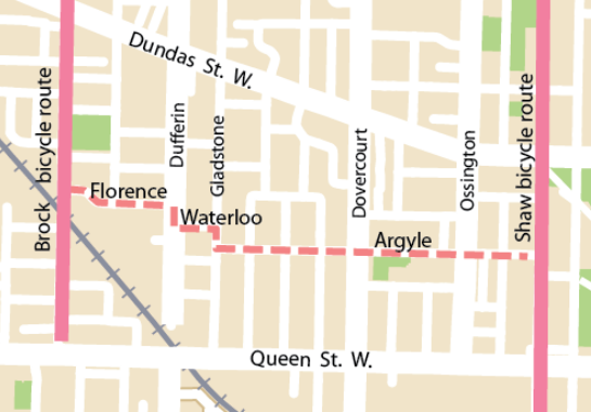
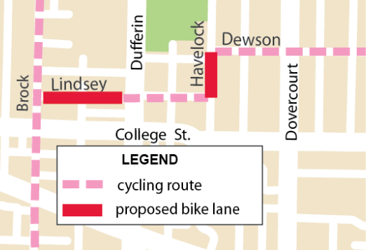
The City had planned the Florence/Argyle and Lindsey/Dewson contraflow plans as a "quick win" back in 2008 as part of a west end bikeways plan. That was before everything got shelved due to (self-imposed) "contraflow legal purgatory". Now City staff are working hard to get the backlog of routes approved and painted, but local cycling groups are arguing that in the hurry they're leaving out the safe crossing bit.

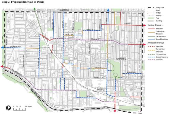
Original 2008 West End Bikeways plan

The west end ward groups of Cycle Toronto—18, 19 and 14—have identified two bike routes where they cross Dufferin at Florence/Argyle and Lindsey/Dewson routes, in particular, as dangerous. In each case they were told that the crossings were too close to other traffic lights, so the staff won't put in additional lights. (Though it boggles my mind that it's perfectly acceptable for Loblaws to get a traffic light merely one block away from Church just for their parking garage, but it's unacceptable for safer bike routes. Clearly Loblaws has a lot of pull with the City. The City has lost the moral high ground on that point.)

Enough of my babbling, the ward groups say it better:

Specifically, we have serious concerns about the proposal to install these bike routes without providing for safe bike crossings at Dufferin Street in either case. While we understand that there is pressure to “get the lanes painted” as soon as possible, we believe that it is irresponsible to proceed with installation without addressing the route deficiencies at Dufferin. We have waited five years for these routes to be installed and, after all this time, it seems reasonable to expect that the designs incorporate safe, signalized crossings for cyclists travelling in both directions at Dufferin. Indeed, this issue was highlighted when City staff engaged in a walking tour of the Argyle contra-flow route with Ward 19 and 18 cyclists in March 2013.

Allow us to put these two routes in the context of what cyclists have actually sought by way of safe cycling routes in Toronto’s west end. Recall that these side-street routes were approved as “quick wins” to be installed after a 2008 public consultation that clearly demonstrated a preference for bike infrastructure on uninterrupted streets with signalized intersections, such as Dundas and Queen.

Florence to Argyle

Always looks easy when looking from above. Lindsey to Dewson

Where Florence meets Dufferin there is a pedestrian-activated crosswalk and a school on the east side with a path going through the school grounds. At Lindsey there is nothing. I expect that many people crossing at Florence will bike through the crosswalk—after activating the light—and then either bike down the sidewalk or through the school grounds. While not ideal, it's workable and we can fully blame the City for forcing this situation. And by City I don't mean to pick just on cycling planners, but the forces that be in Transportation Services that hold back more appropriate cycling infrastructure in favour of their golden calf, automobile throughput.

All hail the Holy Car.